Why Get Roof Measurements from Satellite?
Sep 20, 2021
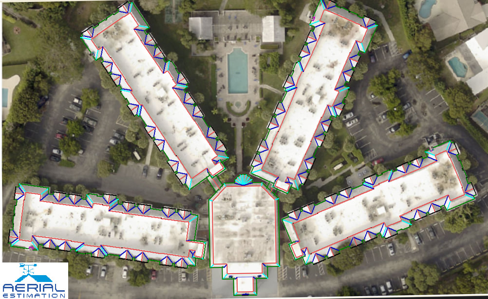
The measurements taken from an aerial picture of your home are known as satellite roof measurements. After that, the software is used to calculate the measurements. With Google Maps' aerial picture of the house, you can actually do it. There is also a device that can tell you how many feet by how many feet the roof is.
We then employ satellite technology to build your estimates, providing you with precise measurements that you can use to select materials without spending more money.