The Value of Aerial Roof Measurements
An aerial roof measurement allows for the remote measurement of a building's roof sections' size, geometry, pitch, and direction, and then uses that information to provide an estimate to fix or replace the roof, or to insert equipment as needed.
Comparing Roof Measurement Methods: Laying Down the Pros and Cons
A few years ago, the only method to obtain a roof measurement was to climb a ladder and measure it with tape. Contractors now have a variety of choices for getting roof measurements due to the high-resolution aerial imaging and other modern technologies.
Why Get Roof Measurements from Satellite?
The measurements taken from an aerial picture of your home are known as satellite roof measurements. After that, the software is used to calculate the measurements. With Google Maps' aerial picture of the house, you can actually do it. There is also a device that can tell you how many feet by how many feet the roof is.
We then employ satellite technology to build your estimates, providing you with precise measurements that you can use to select materials without spending more money.
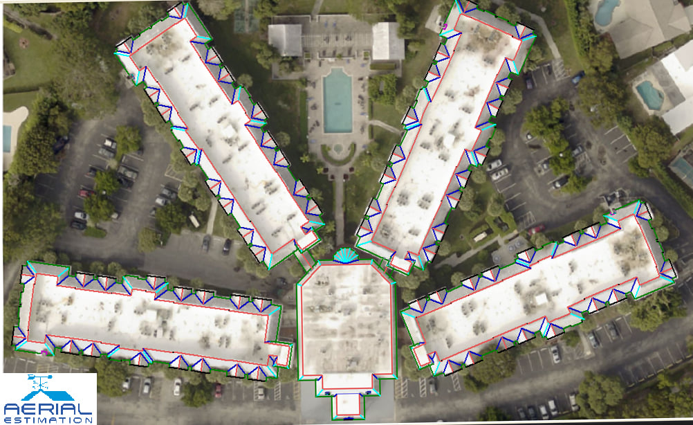
What Is an Aerial Roof Measurement Report?
The Roof Measurement Report offers a thorough examination of your roof's structure as well as all key dimensions. This report helps you to save time and allows you to get reliable roof repair or replacement estimates.
Aerial measurement reports are a substantially faster and more efficient way to acquire roof measurements. Rather than scaling a ladder to measure a roof by hand and manually typing measurements into an estimate, the overall method can be performed digitally, saving time and reducing roof measurement errors.