Why Get Roof Measurements from Satellite?
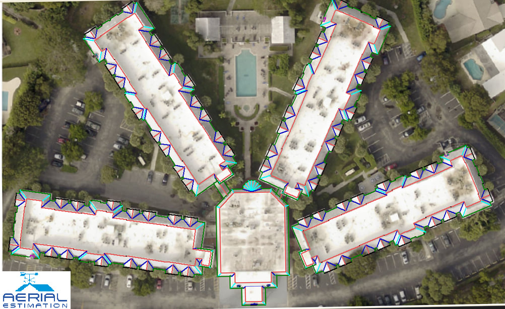
The measurements taken from an aerial picture of your home are known as satellite roof measurements. After that, the software is used to calculate the measurements. With Google Maps' aerial picture of the house, you can actually do it. There is also a device that can tell you how many feet by how many feet the roof is.
We then employ satellite technology to build your estimates, providing you with precise measurements that you can use to select materials without spending more money.
If you hire a contractor, he will bill you to take roof measurements and then increase material costs. In this manner, you pay for the estimates and then spend even more on the materials.
When you use our reports, you will obtain real-time estimates and a direct channel to material suppliers, allowing you to understand what materials really cost.
Aerial roof estimates save you the trouble of climbing a ladder and risking your life for a few scribbled notes on a piece of paper, but a lot more things are there.
This is the most accurate and best method for measuring your roof. You don’t have to stand under the burning sun all day while battling your roof for the position. Your entire job will be done with just a few clicks. Make use of those hours to plan out any of your projects.
If you hire a contractor to take roof estimates, they have complete control over you. They would choose the job and materials, and then you will be forced to pay for operating costs.
Satellites are more precise than the hands of the most common contractor. You'll obtain exact roof estimates without any human error. We will even provide you with a pricing estimate based on standard roofing materials. Refer What is an Aerial Roof Measurement Report? On our blog for more details.
Now Aerial Estimation offers satellite roof measurements free trial to test accuracy and turn around time.